


By Rob Alway
On Nov. 11, 1940, one of the most devastating storms in Great Lakes history swept across the Midwest,
turning an unusually mild Armistice Day into a catastrophe that claimed an estimated 154 lives.
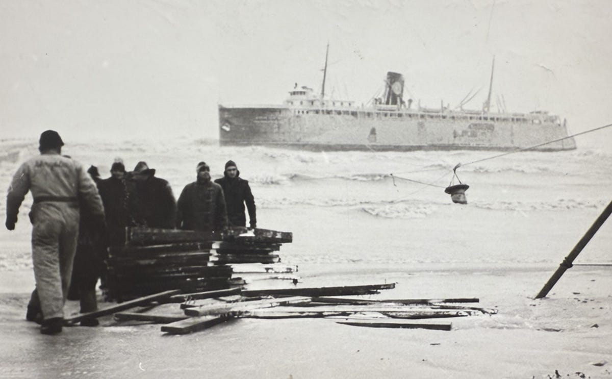
On Lake Michigan, three freighters sank along a relatively short stretch of shoreline between Ludington, Michigan and Little Point Sable, taking 59 mariners to their deaths. A railroad carferry was driven aground at Ludington, another barely reached the safety of the harbor, and fishing tugs farther south disappeared into the violent seas.
The sinking of Edmund Fitzgerald on Lake Superior on Nov. 10, 1975, with the loss of 29 sailors, remains one of the most widely remembered tragedies in Great Lakes maritime history. Yet the Armistice Day Storm, which struck 35 years earlier, claimed more than five times as many lives across the Midwest. The three freighters lost off the shores of Mason and Oceana counties alone accounted for more than twice the death toll of Edmund Fitzgerald.
The storm’s extraordinary violence was compounded by the speed of its arrival. Ships already underway, fishermen working the lake and communities along the shoreline were caught in a rapidly intensifying weather system that would become one of the deadliest storms in the region’s history.
A deceptive calm and an extraordinary storm
Between Oct. 25 and the afternoon of Monday, Nov. 11, 1940, the weather around Ludington had been largely mild and dry. Temperatures climbed toward 65 degrees on Armistice Day. Local residents were preparing for a 7:30 p.m. parade, and the forecast printed in the Nov. 9 edition of the Ludington Daily News had mentioned only light rain and possible snow flurries for Monday. Nothing in that public forecast suggested what was approaching.
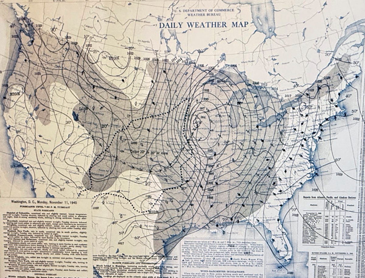
The storm had an earlier history far to the west. A strong weather system entering the Pacific Northwest had brought damaging winds to Washington state. On Nov. 7, the Tacoma Narrows Bridge in Pierce County collapsed. The suspension bridge, then the world’s third-longest, had already earned the nickname “Galloping Gertie” for its wind-driven movement. In winds of 35 to 45 mph, its center span rose and fell an estimated 3 to 5 feet before failing, even before the center of the storm reached the coast. On Nov. 8 the low-pressure center remained offshore, generating gale-force winds as pressure continued to fall over the Pacific Northwest.
By Nov. 10, the system had crossed the Rocky Mountains and redeveloped around Trinidad, Colorado. After initially tracking eastward, it curved north into the central United States. Within six hours, the low moved toward Iowa Falls, Iowa. Blizzards swept South Dakota, a widespread ice storm struck Nebraska, and warm air surged northward along the Mississippi Valley. A tornado was reported about a mile west of Davenport, Iowa. Two to 3 inches of rain fell across the Mississippi Valley while heavy snow spread over Minnesota and western Iowa.
At the U.S. Weather Bureau in Chicago, forecasters returned on Monday morning after a customary half-day Sunday schedule to find a storm that had not dissipated in the Rockies as expected. Instead, it had moved through Idaho, Wyoming and Colorado and had converged over Iowa with an Arctic cold front and a warm front from the south. Barometric readings fell to exceptional lows. The National Weather Service records 28.72 inches of mercury at La Crosse, Wisconsin, and 28.66 inches at Duluth, Minnesota—readings that set local records at the time.
At the meeting point of those weather systems, warm air rose and cold air plunged downward, feeding cyclonic winds. Forecasters recognized an enormous, roughly 1,000-mile-wide windstorm heading for Chicago by noon and then up the length of Lake Michigan. They anticipated mountainous waves, snow and sharply falling temperatures. Storm warnings went out across the Midwest. By 6:30 a.m., Coast Guard stations and weather posts along Lake Michigan were hoisting storm flags for vessels that had no way to receive new warnings at sea.
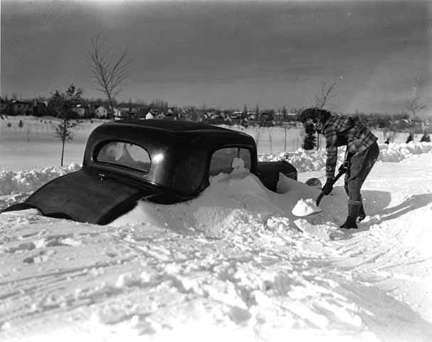
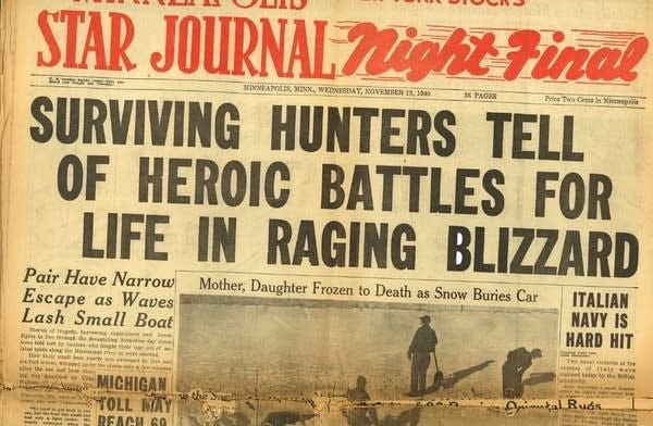
The danger reached well beyond the Great Lakes. Duck hunters along the upper Mississippi River had gone out in the unseasonably pleasant conditions, many without cold-weather clothing. As winds reached 50 mph and waves rose to 5 feet, hunters who had taken refuge on small river islands were overwhelmed. Others tried to return to shore and drowned. Temperatures fell below 10 degrees overnight, leaving some stranded hunters to freeze. The storm killed 49 people in Minnesota; National Weather Service accounts specifically describe 12 duck hunters who were trapped along a stretch of the Mississippi River.
In Ludington, the first round of high winds and heavy rain arrived around 2 p.m., bringing relatively minor damage. Conditions eased near 3 p.m., but the respite was brief. Around 5 p.m., the storm returned with far greater force. Gusts were reported as high as 100 mph, and Lansing Shoals Light Station in northeastern Lake Michigan, near Michigan’s Upper Peninsula, reportedly recorded a 120-mph gust.
Paul S. Peterson, managing editor of the Ludington Daily News, recalled the storm in an article published Nov. 11, 1975. Carferries trying to reach Ludington or the Wisconsin shore, he wrote, “had all they could do to stay afloat.” He also described a flotilla of seven Great Lakes Naval Reserve submarine chasers that had gathered in Ludington on Sunday while en route to the Brooklyn Navy Yard. The vessels were battered at anchor, and two suffered considerable damage.
Among the ships near the eastern shore between Ludington and Little Point Sable were the Pere Marquette Railway flagship City of Flint 32 and carferry Pere Marquette 21, as well as the freighters Anna C. Minch, Novadoc and William B. Davock. Of these five vessels, three would sink, one would run aground, and one would barely reach harbor.
Next in the series: The gale drives a Pere Marquette carferry onto the beach at Ludington and leaves other vessels fighting for survival.
Sources: National Weather Service; Ludington Daily News; contemporary accounts cited in the original article.